PARADEPLEIN
- Museum Kota Lama
- Oct 13, 2023
- 1 min read

"After the city fort until medio 20th century, the location of this open space was called the 'Paradeplein' which slowly turned into a public park."
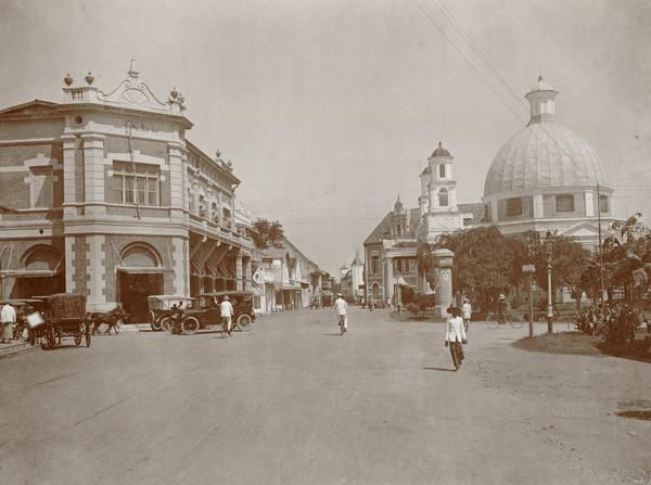
During the era of Fort de Vijfhoek, this open space was located approximately 400 meters to the east of the fort. Upon entering the city fort era, the area functioned as a church garden and cemetery. After the city fort until the middle of the 20th century, the location of this open space was called the "Paradeplein" which slowly turned into a public park. The boundaries of the paradeplein can still be seen in the open spaces between Jalan Taman Srigunting and Jalan Letjen Suprapto. The paradeplein is to courtyards that are square on the west side and square on the east side. Unique components that complement the paradeplein include a music pavilion, billboard poles, and several buildings. One of the most important buildings in the area is the Semarangsche Bazar.
Semarangsche Bazar was established in 1890 as a grocery store selling various household and office goods. Besides selling goods, Semarangsche Bazar also provided courier expedition services. In 1896, the name changed to Semarangsche Bazar "Eigen Hulp" (Semarang Community Self-Help Bazaar). His Majesty Pakubuwono X visited Semarangsche Bazar "Eigen Hulp" during his visit to Semarang in 1903. Today, the Semarangsche Bazar Eigen Hulp building is better known as Gedung Oudetrap.


Comments